• Home
  • AFFILIATIONS
  • RESUME
  • C0NSULTING
    • FEE SCHEDULE
  • PUBLICATIONS
    • AMARGOSA VALLEY
    • BATOPILAS
    • DEATH VALLEY MINERALS >
      • Billie Borate Mine
    • INYO MOUNTAINS >
      • Cerro Gordo
      • Darwin Mine
    • LORAINE MINING DISTRICT >
      • Studhorse Maps
      • Studhorse Appendicies
      • FIELD NOTES
    • MOJAVE DESERT >
      • AMBOY CRATER
      • BRUBAKER-MANN
      • BRISTOL MOUNTAINS >
        • Lava Hills-Black Ridge Area
      • BRISTOL DRY LAKE
      • CADY MOUNTAIN >
        • Mine Reports
      • CALICO MINING DISTRICT >
        • Calico Maps
        • Mine Reports
      • CASTLE MOUNTAINS
      • CAVE MOUNTAINS
      • CINDER CONES-LAVA BEDS DISTRICT
      • CLARK MOUNTAINS >
        • Colosseum Mine
        • Copper World Mine
        • Mountain Pass Mine
      • CRONESE, CAVE AND NORTHERN CADY MOUNTAINS
      • EL DORADO CANYON, NV
      • EXCHEQUER MINING DISTICT >
        • MINES OF EXCHEQUER DISTRICT
      • KRAMER BORATE DISTRICT
      • KELSO DUNES
      • IVANPAH, MESCAL AND CLARK MOUNTAINS >
        • Stratigraphy: Ivanpah, Clark, Mescal
        • Structure of the Clark, Mescal and Ivanpah Mountains
        • Geology and Mining History
        • Mine Reports
      • LANE MOUNTAINS
      • LAVA BED MOUNTAINS >
        • Mine Reports Lava Bed Mountains
      • LEAD MOUNTAINS
      • MOJAVE MINING DISTRICT >
        • Brown Butte Group
        • Horned Toad Hills
        • Middle Butte - Cactus Queen
        • Rosamond Hills >
          • Rosamond Hills MInes
        • Standard Hill - Elephant Butte >
          • Mine Reports Standard Hill Mines
        • Soledad Mountain
        • South of Oak Creek Canyon
        • Willow Springs Mnt - Tropico >
          • Tropico Mines
      • NEW YORK MOUNTAINS
      • NORTHERN BULLION MOUNTAINS >
        • Mines of the Northern Bullion MntsNES OF THE NORTHERN BULLION MOUNTAINS
      • NORTHERN HALLORAN SPRINGS MINING DISTRICT >
        • Mines of the Northern Halloran District
      • OLD DAD AND KELSO MOUNTAINS >
        • Seventeen Mile Point Area
      • PROVIDENCE MOUNTAINS >
        • Vulcan Iron Mine
      • PANAMINT RANGE >
        • Briggs Gold Mine
      • RANDSBURGH DISTRICT
      • SEARLES LAKE
      • SOUTHERN SPRING MOUNTAINS (GOODSPRINGS) MINING DISTRICT >
        • MINES OF THE SPRING MOUNTAINS (SOUTHERN) MINING DISTRICT
    • OIL AND GAS >
      • OIL SEEPS >
        • Fresno County Oil Seeps
        • Kern County Oil Seeps
        • Los Angeles County Oil Seeps
        • Santa Barbara Oil Seeps
    • OWENS VALLEY MINES
    • PALEONTOLOGY
    • POLONIUM PLEOCHROIC HALOES
    • SAN DIEGO COUNTY
    • SIERRA NEVADA >
      • SOUTHERN SIERRA NEVADA
    • WHITE MOUNTAINS - VOLCANIC TABLELANDS
  • GUIDEBOOKS
    • COAST RANGES CALIFORNIA >
      • Santa Maria to Cuyama Valley 1996
      • Santa Maria - La Panza - Carrizo - Cuyama Valley, 2016
      • Cuyama to Point Sal
      • Maricopa to Carpinteria
      • Ventura Basin
      • Carpinteria Oil Seeps
    • DEATH VALLEY >
      • Northern Death Valley
      • Southern Death Valley
    • MOJAVE DESERT GUIDEBOOKS >
      • OLD MOJAVE ROAD
      • DESERT SYMPOSIUM 2023
    • MOTHER LODE >
      • PART I MARIPOSA TO JACKSON
      • PART II: JACKSON TO GRASS VALLEY
      • PART III: GRASS VALLEY TO TAYLORSVILLE
      • Terranes
    • OLD RIDGE ROUTE
    • OWENS VALLEY AND MONO BASIN >
      • GEOLOGIC MAPS
      • Bridgeport-Bodie-Aurora
    • SAN ANDREAS FAULT >
      • ARCH E 1:24K MAPS
    • SAN JOAQUIN VALLEY
    • SALTON SEA REGION >
      • SALTON SEA AREA MINES
    • SOUTHERN SIERRA NEVADA GUIDEBOOKS >
      • KERN CANYON, LAKE ISABELLA, WALKER BASIN
  • FIELD TRIPS
    • FIELD TRIP SCHEDULE
    • Avenza
    • Mines and Wines
    • COAST AND TRANSVERSE RANGES
    • DEATH VALLEY FIELD TRIPS
    • DESERT SYMPOSIUM
    • OWENS VALLEY AND MONO BASIN
    • MOTHER LODE FIELD TRIPS
    • MOJAVE DESERT FIELDTRIPS
    • SAN ANDREAS FAULT FIELD TRIPS
    • SAN FERNANDO VALLEY
    • SAN JOAQUIN VALLEY FIELD TRIPS
    • SIERRA NEVADA FIELD TRIPS
    • WHITE MOUNTAINS - INYO MOUNTAINS
  • GEOLOGY AND HOLLYWOOD
    • Alphabetical Listing of Movies
    • Chronological Listing of Movies
    • Descriptions by date
    • Descriptions by Title
    • Syllabus
    • TRAILERS
  • EARTH SCIENCE COURSE
    • POWER POINT PRESENTATIONS >
      • Introduction and Scientific Method
      • Minerals and Matter >
        • Minerals Quiz
      • Rocks >
        • Igneous Rocks >
          • Volcanoes and Plutonic Rocks
          • Igneous Rock Classification Lab >
            • Igneous Rock Quiz
        • Sedimentary Rocks >
          • Lab Sedimentary Rock Classification >
            • Sedimentary Rock Quiz
        • Metamorphic Rocks >
          • Lab Metamorphic Classification >
            • Metamorphic Rock Quiz
      • Weathering and Erosion
      • Water, Streams, and Floods >
        • Labs for Water Resources >
          • Videos Water and CA
          • Stream Processes Lab is >
            • Quiz for Streams
      • Groundwater
      • Earthquakes
      • Volcanoes
      • Plate Tectonics
      • Geologic Time
      • Evolution of the Earth >
        • Big Bang to Protoearth
        • Protoearth to Phanerozoic
        • Paleozoic
        • Mesozoic
        • Cenozic >
          • Global Warming
      • Fossils
      • Atmosphere and Weather >
        • Physical Geology Atmosphere
        • Integrated Atmosphere
        • Earth Science Atmosphere
      • Oceans and Coasts
      • Global Wind Patterns and Clouds
      • Deserts and Winds >
        • Quiz for Deserts
      • Glaciers and Glaciations >
        • Quiz for Glaciers
      • Topographic Maps >
        • Kernville
        • Miracle Hot Springs
        • Bakersfield
        • Rio Bravo Ranch
      • Structural Geology
      • Solar System
      • Beyond the Solar System >
        • Video Beyond the SS
    • DISCUSSIONS
    • MID TERMS AND FINAL EXAM
    • HOMEWORK
    • QUIZZES
    • ASSIGNMENTS >
      • Mineral
      • Rocks
      • CA Groundwater Basins
      • Landslide
      • Plates
      • Earthquakes
      • Volcanoes
      • Evolution of the Earth
      • Geologic time
      • Assignment and Current Grade
      • GEOLOGIC SCAVENGER HUNT
  • Journal
  • MINE ENGINEERING
  • ARCHAEOLOGY AND THE OLD TESTAMENT
    • CHAPTERS
    • POWER POINT LECTURES
    • VIDEOS AOT
  • WALK THROUGH TIME
  • Collecting Sites
  • Get in Touch
CLICK BOX FOR WEBSITE MENU

RESUME

           
EDUCATION:
1972  Polytechnic High School, Riverside, California
1977  B.A., Geology, University of California at Santa Barbara
1983  Doctor of Geologic Science, University of Texas, El Paso
 
CREDENTIALS:
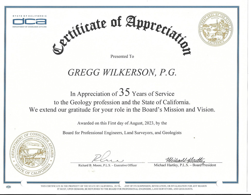
Professional California Geologist #4380 (9/2/87)
​
American Association of Petroleum Geologists #0540555 (1977)
Geological Society of America #1966070 (1987)
Certified Mineral Examiner #0085 (1993) (now inactive)
 
LANGUAGES:
 English, Spanish
 
EXPERIENCE: Multi-cultural work experience in geology, economic analysis and environmental management includes tours of duty at 3 universities, 6 mining companies, and 2 government agencies since 1974.  I coordinate complex interdisciplinary projects involving teams of up to 20 specialists for mineral resource appraisal. Have managed or investigated projects in all western United States, Canada, Mexico, Chili and Honduras.
 
EXPERTISE
 I have a unique combination of geologic modeling, economic evaluation and ArcGIS map making skills. These skills have been applied to research in mining districts throughout California for the past 42 years. This experience has formed of my theories of ore deposit genesis, means of exploring for them, and appraisal methodologies for evaluating them. I also have extensive exploration in the cleanup of abandoned mine sites and served as project manager for CERCLA actions at the Klau-Buena Vista Superfund Site. I have also lead several interdisciplinary teams. I am an expert in environmental permitting and land use planning, and geologic applications for ArcGIS technologies.
 
Employment History:
 
1. California State University Bakersfield
I am an adjunct lecturer for ArcGIS for Natural Sciences and Geology and Economic Geography of Ore Deposits.
From 2004 to Present

2. California State University, San Bernardino
I am an adjunct lecturer for ArcGIS for Geologic Sciences
From 20016 to 20017


3. U.S. Forest Service
Custer National Forest
Watford City, ND  58854           
From: 08/84  To: 12/85
 
Worked on mineral appraisals and computer modeling/reporting programs for projects in Montana, North and South Dakota.
 
Evaluate and process Applications for Permit to Drill (APD'S) for oil and gas wells and special use road permits. Perform on-site inspections. Write Environmental Assessments, Categorical Exclusions, and Statements of Work for Environmental Impact Statements (EIS). Maintain coordination with range and wildlife concerns and state and federal wildlife agencies. Process seismic exploration permits. Supervise and monitor rehabilitation of well pads and access roads. Maintain good public relations through presentations and community involvement. Perform computerized data management on FLIPS (General Data). Surface geologic mapping, sampling, and report writing for mineral reports. These studies were done for environmental documents, material sales and land exchanges. Write lease stipulations for coal leases.                   
 
4. Wilkerson Exploration
B.M. Construction Company
259 Manzanita Ave           
Ventura, CA  90031  
 From: 06/80  To: 08/84 
 
Consultant for mineral projects in western United States and Mexico.
 
Management of exploration programs for mineral deposits. Contract bidding, sub-contract recruitment, personnel management. Evaluation of mining properties. Computer-assisted cost analysis, ore body modeling and ore reserve calculations. Management of land acquisition and claim staking programs. Interpretation of geophysical data. Stratigraphic, structural, and economic analysis. Geophysical studies and computer graphics presentations.              
 
5. Earth Science Department
New Mexico State University
Las Cruces, NM  88004              
From: 09/80 To: 06/81
 
Visiting Assistant Professor and consultant for geologic modeling and economic analysis for projects in New Mexico, Texas and Mexico.
 
6. Geology Department
University of Texas at El Paso              
El Paso, TX  79968
From: 01/78 To: 07/80
 
Teaching and geologic research and economic geology of the Batopilas Mining District, Chihuahua Mexico, and other areas in Mexico, Texas and California.
 
7. Petrotomics Inc (Getty Oil Co.)
P.O. Box 2509            
Shirley Basin, WY 82615
From: 06/79 To: 09/79
 
Economic analysis, ore reserve calculations for open pit uranium mine.
 
8. Kerr-McGee Corporation
401 East “E” St.
Casper, WY  82601
From: 06/78  To: 06/78
 
Supervised 5 drill rigs and crews for uranium exploration (sandstone type orebodies) in Montana, Wyoming, North and South Dakota.
 
9. Hecla Mining Company
Lakeshore Mine
Casa Grande, AZ  85222
From: 12/76  To: 03/77
 
Grade control, geologic modeling and economic analysis for underground (block caving) copper deposit.
 
10. Geological Survey
University of California
Santa Barbara, CA  93017
From: 06/76  To: 09/76
 
Geologic mapping throughout Southern California.
 
11.  Dresser Industries (Greystone)
P.O. Box 375  
Battle Mountain, NV 89820
From: 06/75  To: 09/75
 
Geologic mapping, mine mapping, sampling and grade control at an open pit barite mine.
 
12. Petrolog Oil Well Logging Co.
459 Dorthy Ave
Ventura, CA  93301
From: 06/73  To: 09/74
 
Oil well logging throughout Southern California.

SUPPLEMENTAL INFORMATION
 
OTHER SCHOOLS AND TRAINING
 
"Management of Drilling Projects", Northwest Mining Association, Spokane, WA  November, 1981.
 
"Application of the Microcomputer to the Evaluation of Mineral and Energy Projects", American Institute of Mining Engineers Short Course, Salt Lake City, Utah, October, 1983.
 
"Wrench Faulting and Hydrocarbon Exploration" Arthur Sylvester, American Association of Petroleum Geologists Short Course, Bakersfield, California, May 13, 1987.
"Practical Petrophysics for Exploration and Development", R.M. Snyder, American Association of Petroleum Geologists Short Course, Bakersfield, California, March 10, 1987.
 
"Open Hole Well Log Interpretation and Analysis", Steve Boljen, Bureau of Land Management, Bakersfield, California, March 24-27, 1987.
 
"Analysis of Fractured Reservoirs", American Association of Petroleum Geologists Research Conference (by invitation only), Snowbird, Utah, May 4-8, 1987.
 
"Mineral Title Examination", Bureau of Land Management, Phoenix Training Center, Oct 3 - Nov 15, 1988.
 
“Condensed Resource Management Plan Shortcourse”, BLM Course 1600-INT-4, July 28-30, 1988.
 
"Care Initiator Course", Westec International, Medic First Aid, November 18, 1997.
 
"24 Hour Safety Training", Bureau of Land Management, December 6-9, 1997
 
"Mine Safety "Mining Safety and Health Administration”, October 10-21, 1998
 
"Safety for Federal Agency Managers and Officials", Controlled Risk International, January 29, 1999.
 
"Basic Aviation Safety Course", Office of Aircraft Services, Department of Interior, March 2, 1999.
 
“Certificate of Participation”, CAMMA 2000, Oct. 11-12, 2000, Las Vegas, NV.
 
"Underground Mine Safety for Abandoned Mine Lands", Phoenix Training Center , March 10-17, 2000.
 
“2001 Mineral Property Tax Assessment Seminar”. Feb. 13, 2001
 
“Advanced Placer Evaluation”, BLM Course 3000-76, Lincoln, Montana, Sept. 10-29, 2001.
 
“Introduction to ArcView”, Sept. 3-Dec. 20, 2001, Bakersfield City College.
 
“Appraisal of Industrial Mineral Deposits”. BLM Course 3000-86, Phoenix Training Center
 
“Leadership Challenge”, BLM Course 140012, April 12-15, 2004, Phoenix Training Center
 
“MSHA Mine Safety Annual Refresher Course”, BLM State Office, Dec. 27, 1997, Oct, 21, 1998; March 28, 2000; Oct. 31, 2001; Nov. 21, 2002; Oct 20, 2003; Feb 12, 2004; Jan. 19, 2005.
 
“Basic Employee Safety Training”, Westec, Taft College, California, June 4, 2005.
 
“Defensive Driving Course”, Westec, Taft College, California, April 8, 2005.
 
“HAZWOPER Training, 40 Hour Site Worker, 29 CFR 1910.120”, Westec, Taft College, California, June 12, 2005.
 
“Emergency Response Technician Training” Westec, Taft College, California, June 12, 2005.
 
“Confined Space Entry Attendant/Entrant + Medic First Aid CIC”, Westec, Taft College, California, June 4, 2005.
 
“Contract Officer Representative Certification: Environmental Services/Construction Contracting,” BLM,  Oct. 14-20, 2006 (40 hours).
 
“Managing Interdisiplinary Teams”, Mission-Centered Solutions, BLM Contractor, April 23-27, 2007 (40 hours).
 
Hazardous Waste Operations/Emergency Response 8-hour Refresher Training, DOI, Sacramento, July 12, 2010.
 
Contract Officer Representative-Contract Officer Technical Representative Refresher Training, March 24-29 (40 hours), 2009, NPI Inc. Training given at Bakersfield, CA.
 
Developing Performance-Based Work Statements, NPI Inc, Phoenix, AZ, April 5-7, 2011.
 
Contract Officer Representative-Contract Officer Technical Representative Refresher Training, (40 Hours), Moreno Valley, CA, May 16-20, 2011.
 
Leadership Environment, Moreno Valley, CA. March 12-13, 2012
 
 
PUBLICATIONS
 
Wilkerson, G., 1982, The Batopilas Mining District, Abstract, Geological Society of America, Cordilleran Section Annual Meeting, Hermoseo, Mexico, 1982.
 
Wilkerson, G., 1983, The Batopilas Mining District, Chihuahua, Mexico, Doctoral Dissertation, University of Texas, El Paso, 1983.
 
Wilkerson, G. and T. Moore, 1986, The Federal Hydrocarbon Reservoir Management Program in California, Pacific Coast Oil Show and Conference, Petro-Tech Expos, Bakersfield, November 4,5,6, 1986.
 
Wilkerson, G., 1987, Pleochroic Haloes, the Arkansas Creation-Evolution trial, and an Autobiography, Book Review of Creation's Tiny Mystery, R. Gentry, Origins Research, Summer-Fall issue, v.10, n.1, 1987.
 
Wilkerson, G., 1987, Hydrocarbon Potential in the Monterey Shale as a Function of Sedimentation, Digenesis, and Tectonic History, Abstract, American Association of Petroleum Geologists Research Conference, Snowbird, Utah, May 4-8, 1987.
 
Wilkerson, G., 1988, The Cerro Colorado, La Bufa, and Satevo Mining Districts, Chihuahua, Mexico, in Stratigraphy, Tectonics and Resources of Parts of the Sierra Madre Occidental Province, Mexico, Guidebook, American Association of Petroleum Geologists-El Paso Geological Society, Southwestern Section Annual Meeting, El Paso, Texas, February 24-28, 1988, p.309-318..
 
Wilkerson, G., R. Llavona, P. Goodell and D. Kropp, 1988, Laumontite from the Batopilas Mining District, Chihuahua, Mexico, co-Stratigraphy, Tectonics and Resources of Parts of the Sierra Madre Occidental Province, Mexico, Guidebook, American Association of Petroleum Geologists-El Paso Geological Society, Southwestern Section Annual Meeting, El Paso, Texas, February 24-28, 1988, p.263-268.
 
Moore, T. and G. Wilkerson, 1988, Tar Sands, Oil Shale, and Heavy Crude Oil Deposits on Federal Lands in California, Research Conference, Canadian Mining Institute, Toronto, Canada
 
Wilkerson, G., 1988, Cyclic Production of Monterey Shale, Abstract,  American Petroleum Institute, San Joaquin Chapter, Annual Meeting, November, 1988.
 
Wilkerson, G., 1988, Cyclic Production of Low-grade Monterey Shale Reservoirs, Selected Papers #7, San Joaquin Geological Society, November 1988, p.39-48.
 
Wilkerson, G., 1988, Hydrocarbon Potential in the Monterey Formation as a Function of Sedimentation, Diagenisis, and Tectonic History", Selected Papers #7, San Joaquin Geological Society, Nov., 1988, p.32-38.
 
Wilkerson, G., Q. Deng, R. Llavona and P. Goodell, 1988, The Batopilas Mining District, Chihuahua, Mexico, Economic Geology, v.83, p.1721-1736.
 
Wilkerson, G., Paleontologic Sites Involving BLM Lands in California, Partners in Paleontology, Oct. 31-Nov. 4, 1994, Colorado Springs, Colorado, (Abstracts).
 
Wilkerson, G., R. Reynolds, D. Lawler and B. Nafus, 1995, Fossil Resources Associated with Federal Lands in California, San Bernardino County Museum Association Quarterly, 42:2:11-18.
 
Wilkerson, G. and J. Hoffer, 1995, Pumice for Stone-washed and Acid-Washed Textiles: Benton Pumice Beds, Mono County, California, in 29th Forum on the Geology of Industrial Minerals: Proceedings, Calif. Div. Mines and Geology., Special Publication 110, p.119-122.
 
Wilkerson G., L. Vredenburgh, T.  Eyde and T. Serenko, 2000, The Franklin Wells Hectorite Deposit, Inyo County, California, Desert Symposium, San Bernardino County Museum.
 
Rytuba, J.J., B.B. Kotlyar, G. Wilkerson and J. Olson, Geochemistry of selected mercury mine-tailings in the Parkfield mercury district, California, USGS Open File Report 01-336, Version 1. 15p.
 
Wilkerson, G., 2004, Field Guide for Day 2, in Abby Howell and Mike Ponek, editors,  The San Andreas Fault and its related giant structures and oil fields in the western San Joaquin Valley-Cuyama Valley Area, May 13-14, 2004, San Joaquin Geological Society, American Association of Petroleum Geologists, p. 33-58.
 
Wilkerson, G., 2004, Wallace Creek, in Abby Howell and Mike Ponek, editors,  The San Andreas Fault and its related giant structures and oil fields in the western San Joaquin Valley-Cuyama Valley Area, May 13-14, 2004, San Joaquin Geological Society, American Association of Petroleum Geologists, p. 75.
 
Wilkerson, G., 2004, Regional Geology of the SanJoaquin Valley West Side Oil Fields, in Abby Howell and Mike Ponek, editors,  The San Andreas Fault and its related giant structures and oil fields in the western San Joaquin Valley-Cuyama Valley Area, May 13-14, 2004, San Joaquin Geological Society, American Association of Petroleum Geologists, p. 77.
 
Wilkerson, G., 2008, Buena Vista Oil Field, in Midway-Sunset Field Trip, San Joaquin Valley – California, April 3, 2008, Ed. Mike Ponek, Dave Sturm and Ken Guenzi, 2008 American Association of Petroleum Geologists Convention, Bakersfield, California, p. 7-8.
 
Wilkerson, G., 2008, Regional Geology of the SanJoaquin Valley West Side Oil Fields, in Midway-Sunset Field Trip, San Joaquin Valley – California, April 3, 2008, Ed. Mike Ponek, Dave Sturm and Ken Guenzi, 2008 American Association of Petroleum Geologists Convention, Bakersfield, California, p. 31-32.
 
Wilkerson, G., Timothy Elam and Robin Turner, 2011, Lake Thompson Pleistocene mammalian fossil assemblage, Rosamond, in The Incredible Shrinking Pliocene, California State University Desert Studies Consortium, Desert Symposium, Abstracts of Proceedings, ed. Robert Reynolds, April, 2011, pp. 88-90.
 
Timothy Elam and Gregg Wilkerson, The Round Mountain Bed of Sharktooth Hill, Kern County, California: Recent Research Yields New Answers to Old Questions, in The Incredible Shrinking Pliocene, California State University Desert Studies Consortium, Desert Symposium, Abstracts of Proceedings, ed. Robert Reynolds, April, 2011, pp. 88-90.
 
 
NON-SUPERVISORY REFERENCES:
 PROVIDED UPON REQUEST
Proudly powered by Weebly
  • Home
  • AFFILIATIONS
  • RESUME
  • C0NSULTING
    • FEE SCHEDULE
  • PUBLICATIONS
    • AMARGOSA VALLEY
    • BATOPILAS
    • DEATH VALLEY MINERALS >
      • Billie Borate Mine
    • INYO MOUNTAINS >
      • Cerro Gordo
      • Darwin Mine
    • LORAINE MINING DISTRICT >
      • Studhorse Maps
      • Studhorse Appendicies
      • FIELD NOTES
    • MOJAVE DESERT >
      • AMBOY CRATER
      • BRUBAKER-MANN
      • BRISTOL MOUNTAINS >
        • Lava Hills-Black Ridge Area
      • BRISTOL DRY LAKE
      • CADY MOUNTAIN >
        • Mine Reports
      • CALICO MINING DISTRICT >
        • Calico Maps
        • Mine Reports
      • CASTLE MOUNTAINS
      • CAVE MOUNTAINS
      • CINDER CONES-LAVA BEDS DISTRICT
      • CLARK MOUNTAINS >
        • Colosseum Mine
        • Copper World Mine
        • Mountain Pass Mine
      • CRONESE, CAVE AND NORTHERN CADY MOUNTAINS
      • EL DORADO CANYON, NV
      • EXCHEQUER MINING DISTICT >
        • MINES OF EXCHEQUER DISTRICT
      • KRAMER BORATE DISTRICT
      • KELSO DUNES
      • IVANPAH, MESCAL AND CLARK MOUNTAINS >
        • Stratigraphy: Ivanpah, Clark, Mescal
        • Structure of the Clark, Mescal and Ivanpah Mountains
        • Geology and Mining History
        • Mine Reports
      • LANE MOUNTAINS
      • LAVA BED MOUNTAINS >
        • Mine Reports Lava Bed Mountains
      • LEAD MOUNTAINS
      • MOJAVE MINING DISTRICT >
        • Brown Butte Group
        • Horned Toad Hills
        • Middle Butte - Cactus Queen
        • Rosamond Hills >
          • Rosamond Hills MInes
        • Standard Hill - Elephant Butte >
          • Mine Reports Standard Hill Mines
        • Soledad Mountain
        • South of Oak Creek Canyon
        • Willow Springs Mnt - Tropico >
          • Tropico Mines
      • NEW YORK MOUNTAINS
      • NORTHERN BULLION MOUNTAINS >
        • Mines of the Northern Bullion MntsNES OF THE NORTHERN BULLION MOUNTAINS
      • NORTHERN HALLORAN SPRINGS MINING DISTRICT >
        • Mines of the Northern Halloran District
      • OLD DAD AND KELSO MOUNTAINS >
        • Seventeen Mile Point Area
      • PROVIDENCE MOUNTAINS >
        • Vulcan Iron Mine
      • PANAMINT RANGE >
        • Briggs Gold Mine
      • RANDSBURGH DISTRICT
      • SEARLES LAKE
      • SOUTHERN SPRING MOUNTAINS (GOODSPRINGS) MINING DISTRICT >
        • MINES OF THE SPRING MOUNTAINS (SOUTHERN) MINING DISTRICT
    • OIL AND GAS >
      • OIL SEEPS >
        • Fresno County Oil Seeps
        • Kern County Oil Seeps
        • Los Angeles County Oil Seeps
        • Santa Barbara Oil Seeps
    • OWENS VALLEY MINES
    • PALEONTOLOGY
    • POLONIUM PLEOCHROIC HALOES
    • SAN DIEGO COUNTY
    • SIERRA NEVADA >
      • SOUTHERN SIERRA NEVADA
    • WHITE MOUNTAINS - VOLCANIC TABLELANDS
  • GUIDEBOOKS
    • COAST RANGES CALIFORNIA >
      • Santa Maria to Cuyama Valley 1996
      • Santa Maria - La Panza - Carrizo - Cuyama Valley, 2016
      • Cuyama to Point Sal
      • Maricopa to Carpinteria
      • Ventura Basin
      • Carpinteria Oil Seeps
    • DEATH VALLEY >
      • Northern Death Valley
      • Southern Death Valley
    • MOJAVE DESERT GUIDEBOOKS >
      • OLD MOJAVE ROAD
      • DESERT SYMPOSIUM 2023
    • MOTHER LODE >
      • PART I MARIPOSA TO JACKSON
      • PART II: JACKSON TO GRASS VALLEY
      • PART III: GRASS VALLEY TO TAYLORSVILLE
      • Terranes
    • OLD RIDGE ROUTE
    • OWENS VALLEY AND MONO BASIN >
      • GEOLOGIC MAPS
      • Bridgeport-Bodie-Aurora
    • SAN ANDREAS FAULT >
      • ARCH E 1:24K MAPS
    • SAN JOAQUIN VALLEY
    • SALTON SEA REGION >
      • SALTON SEA AREA MINES
    • SOUTHERN SIERRA NEVADA GUIDEBOOKS >
      • KERN CANYON, LAKE ISABELLA, WALKER BASIN
  • FIELD TRIPS
    • FIELD TRIP SCHEDULE
    • Avenza
    • Mines and Wines
    • COAST AND TRANSVERSE RANGES
    • DEATH VALLEY FIELD TRIPS
    • DESERT SYMPOSIUM
    • OWENS VALLEY AND MONO BASIN
    • MOTHER LODE FIELD TRIPS
    • MOJAVE DESERT FIELDTRIPS
    • SAN ANDREAS FAULT FIELD TRIPS
    • SAN FERNANDO VALLEY
    • SAN JOAQUIN VALLEY FIELD TRIPS
    • SIERRA NEVADA FIELD TRIPS
    • WHITE MOUNTAINS - INYO MOUNTAINS
  • GEOLOGY AND HOLLYWOOD
    • Alphabetical Listing of Movies
    • Chronological Listing of Movies
    • Descriptions by date
    • Descriptions by Title
    • Syllabus
    • TRAILERS
  • EARTH SCIENCE COURSE
    • POWER POINT PRESENTATIONS >
      • Introduction and Scientific Method
      • Minerals and Matter >
        • Minerals Quiz
      • Rocks >
        • Igneous Rocks >
          • Volcanoes and Plutonic Rocks
          • Igneous Rock Classification Lab >
            • Igneous Rock Quiz
        • Sedimentary Rocks >
          • Lab Sedimentary Rock Classification >
            • Sedimentary Rock Quiz
        • Metamorphic Rocks >
          • Lab Metamorphic Classification >
            • Metamorphic Rock Quiz
      • Weathering and Erosion
      • Water, Streams, and Floods >
        • Labs for Water Resources >
          • Videos Water and CA
          • Stream Processes Lab is >
            • Quiz for Streams
      • Groundwater
      • Earthquakes
      • Volcanoes
      • Plate Tectonics
      • Geologic Time
      • Evolution of the Earth >
        • Big Bang to Protoearth
        • Protoearth to Phanerozoic
        • Paleozoic
        • Mesozoic
        • Cenozic >
          • Global Warming
      • Fossils
      • Atmosphere and Weather >
        • Physical Geology Atmosphere
        • Integrated Atmosphere
        • Earth Science Atmosphere
      • Oceans and Coasts
      • Global Wind Patterns and Clouds
      • Deserts and Winds >
        • Quiz for Deserts
      • Glaciers and Glaciations >
        • Quiz for Glaciers
      • Topographic Maps >
        • Kernville
        • Miracle Hot Springs
        • Bakersfield
        • Rio Bravo Ranch
      • Structural Geology
      • Solar System
      • Beyond the Solar System >
        • Video Beyond the SS
    • DISCUSSIONS
    • MID TERMS AND FINAL EXAM
    • HOMEWORK
    • QUIZZES
    • ASSIGNMENTS >
      • Mineral
      • Rocks
      • CA Groundwater Basins
      • Landslide
      • Plates
      • Earthquakes
      • Volcanoes
      • Evolution of the Earth
      • Geologic time
      • Assignment and Current Grade
      • GEOLOGIC SCAVENGER HUNT
  • Journal
  • MINE ENGINEERING
  • ARCHAEOLOGY AND THE OLD TESTAMENT
    • CHAPTERS
    • POWER POINT LECTURES
    • VIDEOS AOT
  • WALK THROUGH TIME
  • Collecting Sites
  • Get in Touch